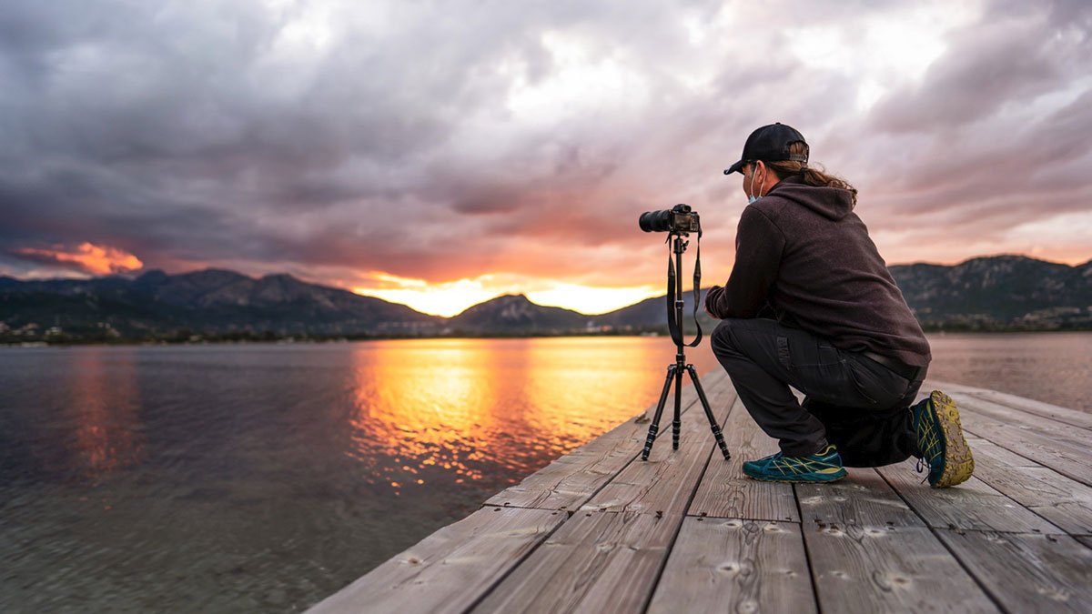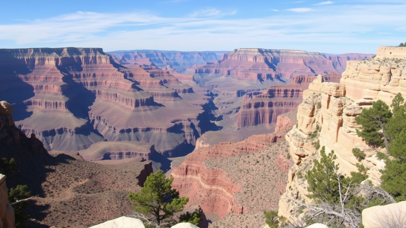
The Grand Canyon offers breathtaking and unique trail running experiences, attracting runners with its stunning views and challenging routes. From the South Rim trails to the inner canyon routes, runners find awe-inspiring natural beauty.
Rim Trail: South Kaibab Trailhead to Hermits Rest
The Rim Trail, extending from the South Kaibab Trailhead to Hermits Rest, presents an accessible and scenic option for runners of all levels. Approximately 13 miles in length, it features both paved and unpaved sections, offering varied terrain underfoot. The paved portions, stretching from Mather Point to Powell Point, provide smooth surfaces ideal for easy jogging and leisurely exploration, while the unpaved sections offer a more natural trail running experience.
One of the major advantages of the Rim Trail is its accessibility. Free from vehicular traffic, it allows runners to fully immerse themselves in the panoramic views of the inner canyon without the distraction of cars or buses. The relatively flat terrain makes it suitable for runners seeking a less strenuous workout, or for those who are new to trail running. However, the length of the trail still provides ample opportunity for a longer run, and the varied surfaces ensure that runners engage different muscle groups.
The Rim Trail is also an excellent option for those who want to combine running with sightseeing. Numerous viewpoints along the trail offer spectacular vistas of the canyon, allowing runners to pause and take in the beauty of the landscape. The trail passes by several iconic landmarks, including Mather Point, Yavapai Point, and Hopi Point, providing opportunities to learn about the geology and history of the Grand Canyon.
For runners looking for a longer and more challenging experience, the Rim Trail can be combined with other trails in the area. It is possible to create loops by connecting to trails that descend into the canyon, such as the Bright Angel Trail or the South Kaibab Trail. However, runners should be aware that these trails are significantly more difficult and require careful planning and preparation.
Bright Angel Trail
The Bright Angel Trail is a classic and challenging route that descends from the South Rim into the heart of the Grand Canyon. This trail is renowned for its stunning scenery and well-maintained path, making it a popular choice for runners seeking an unforgettable experience. However, its steep grade and significant elevation change demand careful planning and preparation.
Starting near the Bright Angel Lodge, the trail winds its way down through layers of geological history, offering breathtaking views at every turn. As runners descend, they will encounter various landmarks such as the 1.5 Mile Resthouse, the 3 Mile Resthouse, and Indian Garden, each providing opportunities to rest and refuel. These rest stops are equipped with water (seasonal availability) and shade, which are crucial for managing the extreme conditions within the canyon.
The Bright Angel Trail is not for the faint of heart. The descent can be deceptively easy, but the ascent is a demanding test of endurance. Runners should be prepared for a strenuous climb, especially during the hotter months. It is essential to carry plenty of water, salty snacks, and sun protection. Starting early in the morning is also highly recommended to avoid the midday heat.
Despite its challenges, the Bright Angel Trail offers a unique and rewarding running experience. The opportunity to immerse oneself in the grandeur of the Grand Canyon is unparalleled. The sense of accomplishment upon reaching the bottom and completing the ascent is immense. However, runners should always prioritize safety and be aware of their limitations.
For those looking for a longer run, the Bright Angel Trail can be combined with other trails in the canyon, such as the South Kaibab Trail, to create a loop. This option is only recommended for experienced trail runners who are comfortable with long distances and significant elevation changes. It is crucial to research the conditions and plan accordingly.
South Kaibab Trail
The South Kaibab Trail is a dramatic and exposed route that plunges directly into the heart of the Grand Canyon, offering unparalleled panoramic views. Known for its steep grade and lack of water sources, it is considered one of the most challenging trails in the canyon, demanding a high level of fitness and careful planning. However, for experienced trail runners seeking an intense and rewarding experience, the South Kaibab Trail is a must-do.
Starting near Yaki Point (accessible by shuttle bus), the trail descends rapidly, switchbacking down the canyon walls. The absence of water along the trail means runners must carry all the water they need, adding to the physical challenge. The exposed nature of the trail also means there is little shade, making it crucial to protect oneself from the sun.
Despite its challenges, the South Kaibab Trail offers some of the most spectacular views in the Grand Canyon. As runners descend, they are treated to breathtaking vistas of the inner canyon, including iconic landmarks such as Ooh Aah Point, Cedar Ridge, and Skeleton Point. The trail also provides a unique perspective on the geological formations of the canyon, showcasing the layers of rock that have been carved over millions of years.
The South Kaibab Trail is often combined with the Bright Angel Trail to create a popular “Rim-to-Rim” loop. This loop involves descending one trail to the Colorado River and ascending the other, providing a diverse and challenging experience. However, this loop is only recommended for experienced trail runners who are comfortable with long distances, significant elevation changes, and the logistical challenges of navigating the canyon.
For those who are not ready for the full Rim-to-Rim loop, the South Kaibab Trail can be run as an out-and-back route. However, runners should be aware that the ascent is extremely strenuous, especially during the hotter months. It is essential to start early in the morning, carry plenty of water, and be prepared for a long and demanding climb.
Tonto Trail (South Rim)
The Tonto Trail, traversing the South Rim of the Grand Canyon, offers a unique and challenging experience for seasoned trail runners. Unlike the rim-to-river trails, the Tonto Trail contours along the Tonto Platform, a broad, relatively flat bench about halfway between the rim and the Colorado River. This single-track trail provides a more horizontal running experience, with rolling hills instead of constant steep ascents and descents, making it a favorite among those seeking a longer, more sustained run.
Accessing the Tonto Trail requires descending one of the canyon’s inner trails, such as the Bright Angel Trail or the South Kaibab Trail. This initial descent adds to the overall difficulty of the run, as runners must first navigate the steep slopes before reaching the relatively level Tonto Platform. However, once on the Tonto Trail, the terrain becomes more manageable, allowing for a more consistent pace.
The Tonto Trail stretches for approximately 70 miles along the South Rim, offering numerous options for creating customized running routes. Runners can choose to run sections of the trail as out-and-back routes, or they can link together different sections to create longer loops. The possibilities are endless, but careful planning is essential due to the lack of water sources and the remote nature of the trail.
One of the major appeals of the Tonto Trail is its solitude. Compared to the more popular rim-to-river trails, the Tonto Trail sees fewer visitors, providing runners with a more secluded and peaceful experience. This allows runners to fully immerse themselves in the beauty of the Grand Canyon, without the distractions of crowds.
However, the remoteness of the Tonto Trail also presents challenges. Runners must be self-sufficient and prepared for any eventuality. Carrying plenty of water, food, and emergency supplies is crucial. It is also important to be aware of the weather conditions, as the Tonto Platform can be exposed to extreme heat and strong winds.
Grand Canyon Greenway
The Grand Canyon Greenway offers a more accessible and less strenuous running option compared to the inner canyon trails. This paved, multi-use path meanders along the South Rim, providing a scenic and relatively flat route for runners of all abilities. The Greenway is ideal for those seeking a leisurely run, a warm-up before tackling more challenging trails, or for families with children who want to enjoy the beauty of the Grand Canyon together.
Stretching for several miles, the Grand Canyon Greenway connects various points of interest along the South Rim, including the Grand Canyon Visitor Center, Mather Point, Yavapai Geology Museum, and Grand Canyon Village. This allows runners to easily access amenities such as restrooms, water fountains, and shuttle bus stops, making it a convenient and well-supported running route.
The paved surface of the Greenway makes it suitable for runners of all fitness levels, including those who prefer to run on a smooth and even surface. The gentle grades and wide path also make it accessible for strollers and wheelchairs, ensuring that everyone can enjoy the beauty of the Grand Canyon.
While the Grand Canyon Greenway may not offer the same level of challenge as the inner canyon trails, it still provides stunning views of the canyon. The path winds along the rim, offering panoramic vistas of the vast expanse below. Runners can enjoy the beauty of the canyon without the physical demands of descending and ascending the steep slopes.
The Grand Canyon Greenway is also a great option for those who want to combine running with sightseeing. The path passes by several iconic landmarks, allowing runners to pause and take in the beauty of the landscape. Informational signs along the way provide insights into the geology, history, and ecology of the Grand Canyon.
Shoshone Point Trail
Shoshone Point Trail offers a serene and relatively easy running experience compared to the more demanding trails within the Grand Canyon. This unpaved, mostly flat trail leads to Shoshone Point, a secluded viewpoint that provides stunning panoramic vistas of the canyon. Its accessibility and gentle terrain make it an ideal option for runners seeking a peaceful and less strenuous run, perfect for a warm-up, cool-down, or a relaxing jog amidst the grandeur of the Grand Canyon.
Unlike many of the more popular viewpoints, Shoshone Point is often less crowded, providing runners with a sense of solitude and tranquility. The trail meanders through a pine forest, offering shade and a respite from the sun, especially during the warmer months. The soft, natural surface of the trail is also gentler on the joints compared to paved surfaces, making it a comfortable option for runners of all ages and fitness levels.
The Shoshone Point Trail is approximately one mile each way, making it a manageable distance for a quick run. The trail is well-maintained and easy to follow, making it suitable for runners who are new to trail running or who prefer a less challenging route. The gentle elevation gain also makes it a good option for those who are acclimating to the altitude of the Grand Canyon.
Upon reaching Shoshone Point, runners are rewarded with breathtaking views of the inner canyon. The viewpoint offers a unique perspective, showcasing the vastness and beauty of the Grand Canyon. It’s a perfect spot to pause, catch your breath, and soak in the stunning scenery before heading back.
While Shoshone Point Trail lacks water sources, its short distance means that runners can easily carry enough water for the duration of the run. It’s also important to be aware of the weather conditions, as the trail can be exposed to sun and wind. However, the relatively short distance and gentle terrain make it a manageable option even in less than ideal conditions.
Hermits Rest Viewpoint to Santa Maria Spring
The run from Hermits Rest Viewpoint to Santa Maria Spring offers a unique and moderately challenging trail running experience along the South Rim of the Grand Canyon. This section of the Rim Trail combines paved and unpaved surfaces with varying elevation changes, providing a diverse and engaging route for runners seeking a more adventurous alternative to the flatter sections of the Rim Trail. The presence of Santa Maria Spring also adds a crucial water source, making it a viable option for longer runs, although treating the water is highly recommended.
Starting at Hermits Rest, the westernmost point accessible by the free shuttle bus, the trail initially follows a paved path along the rim, offering stunning views of the canyon. As runners head east, the trail transitions to a more rugged, unpaved surface, winding through forests and along the canyon’s edge. This section provides a more intimate experience with the natural environment, allowing runners to connect with the landscape on a deeper level.
The elevation changes along this route are more significant than on the flatter sections of the Rim Trail, providing a more challenging workout for runners. The trail dips in and out of side canyons, requiring runners to navigate steeper ascents and descents. This variation in terrain helps to engage different muscle groups and adds to the overall challenge of the run.
Santa Maria Spring, located approximately 3 miles from Hermits Rest, provides a welcome water source for runners. However, it is crucial to treat the water before drinking, as it may contain bacteria or other contaminants. Water filters or purification tablets are essential for ensuring the safety of the water.
The run from Hermits Rest to Santa Maria Spring can be done as an out-and-back route, providing a total distance of approximately 6 miles. Runners can also choose to continue further along the Rim Trail, extending their run and exploring more of the canyon’s rim. However, it is important to be aware of the distance, elevation changes, and water availability when planning a longer run.
Rim-to-Rim-to-Rim (R2R2R)
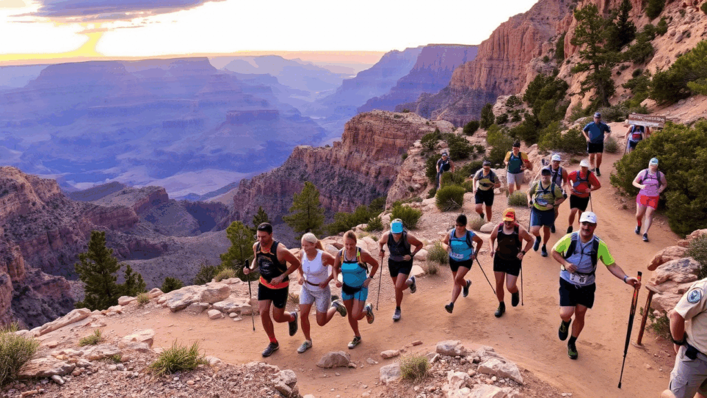
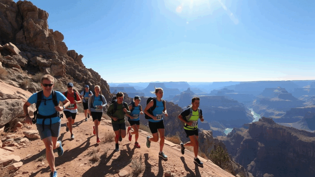
The Rim-to-Rim-to-Rim (R2R2R) is an iconic and incredibly demanding trail running challenge in the Grand Canyon, involving a double crossing of the canyon from the South Rim to the North Rim and back again. This epic undertaking is not for the faint of heart, requiring exceptional physical fitness, meticulous planning, and extensive experience in long-distance trail running. The R2R2R is considered one of the most challenging and rewarding running experiences in the world, attracting experienced ultra-runners from around the globe.
The typical R2R2R route involves descending either the South Kaibab Trail or the Bright Angel Trail to the Colorado River, crossing the river via the Black Bridge or the Silver Bridge, ascending the North Kaibab Trail to the North Rim, and then reversing the route back to the South Rim. The total distance is approximately 42 to 46 miles, with over 10,000 feet of elevation gain and loss. The extreme elevation changes, coupled with the challenging terrain and potential for extreme temperatures, make the R2R2R a true test of endurance.
Successful completion of the R2R2R requires careful planning and preparation. Runners must be in excellent physical condition, with extensive experience in long-distance trail running and hiking. They must also be prepared for the logistical challenges of the route, including water availability, weather conditions, and potential hazards.
Water is a critical consideration for the R2R2R. Water sources are available along the route, but they are not always reliable. Runners must carry enough water to sustain them between water sources and be prepared to treat water from natural sources. It is also important to be aware of the potential for dehydration and heat exhaustion, especially during the hotter months.
The weather in the Grand Canyon can be unpredictable, with extreme temperature swings possible in a single day. Runners must be prepared for a wide range of conditions, including heat, cold, wind, and rain. Layering clothing is essential, and runners should carry rain gear and extra layers in case of inclement weather.
Rainbow Rim Trail
The Rainbow Rim Trail offers a unique and secluded trail running experience on the North Rim of the Grand Canyon. Unlike the more popular and heavily trafficked trails on the South Rim, the Rainbow Rim Trail provides a sense of solitude and immersion in nature. This 18-mile (one-way) trail meanders along a remote section of the rim, offering stunning views of the canyon from various viewpoints. Its relatively flat terrain and soft, pine-needle-covered surface make it a comfortable and enjoyable option for runners of all abilities, especially those seeking a peaceful escape from the crowds.
The Rainbow Rim Trail is located on the Kaibab Plateau, a high-elevation plateau north of the Grand Canyon. The trail winds through a forest of ponderosa pines and aspen trees, providing shade and a pleasant aroma. The soft, natural surface of the trail is gentle on the joints, making it a comfortable option for longer runs. The relatively flat terrain also makes it a good option for runners who are new to trail running or who prefer a less challenging route.
The main attraction of the Rainbow Rim Trail is the stunning views of the Grand Canyon. The trail passes by several viewpoints, each offering a unique perspective of the canyon. These viewpoints are often less crowded than those on the South Rim, providing runners with a more intimate and peaceful experience.
The Rainbow Rim Trail is a point-to-point trail, meaning that runners will need to arrange transportation to either the start or end of the trail. It is also important to be aware of the water availability on the trail. There are no reliable water sources along the Rainbow Rim Trail, so runners must carry all the water they need. It is also important to be prepared for the weather conditions, as the Kaibab Plateau can experience extreme temperature swings.
Despite the logistical challenges, the Rainbow Rim Trail offers a unique and rewarding running experience for those seeking solitude and stunning views. Its relatively flat terrain, soft surface, and secluded location make it a perfect escape from the crowds and a chance to connect with nature.